Header image: An old image taken on a previous trip to the Glasshouse Mtns.
Glasshouse in July
 Click to enlarge.
Thursday, July 16th 2015.
HEMA App Track Stats:
Total track distance - 39.4kms.
Not that I could really spare the fuel but I was itching to get out of the house and although this was not a scheduled group event, I had already invited a member to ride shotgun and I threw it up on the group's page. One vehicle with two people soon became 4 vehicles with 6 people.
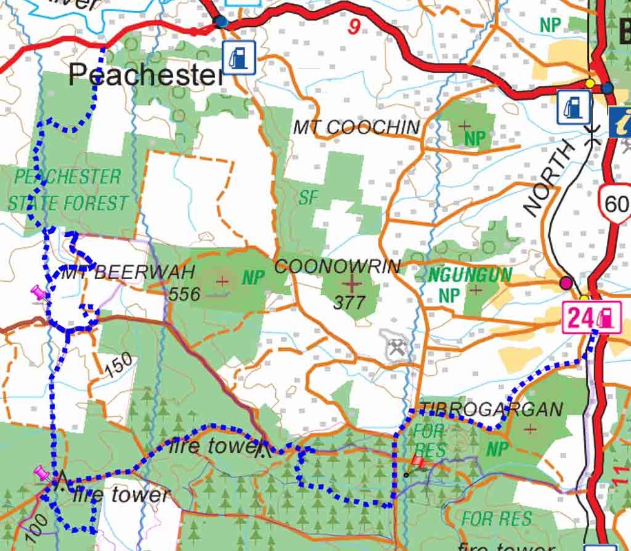
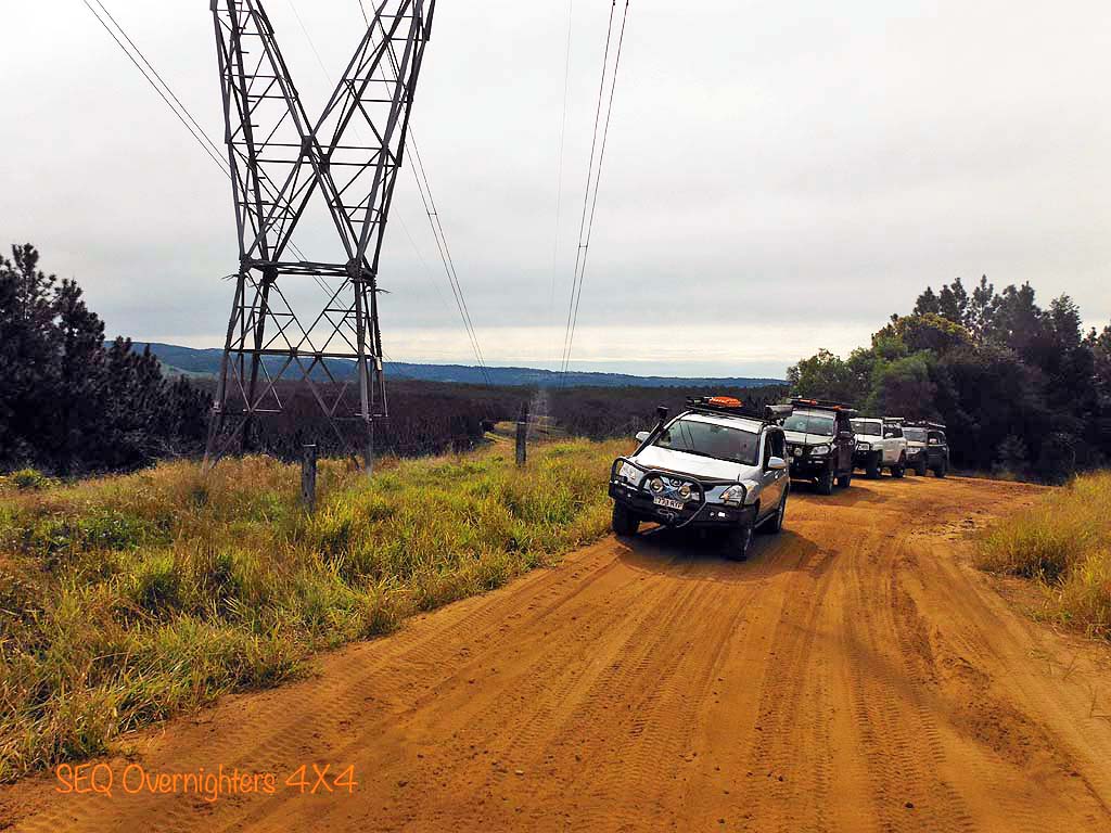
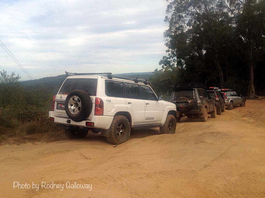
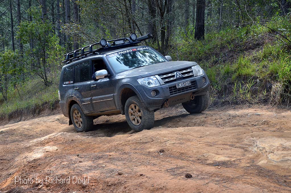
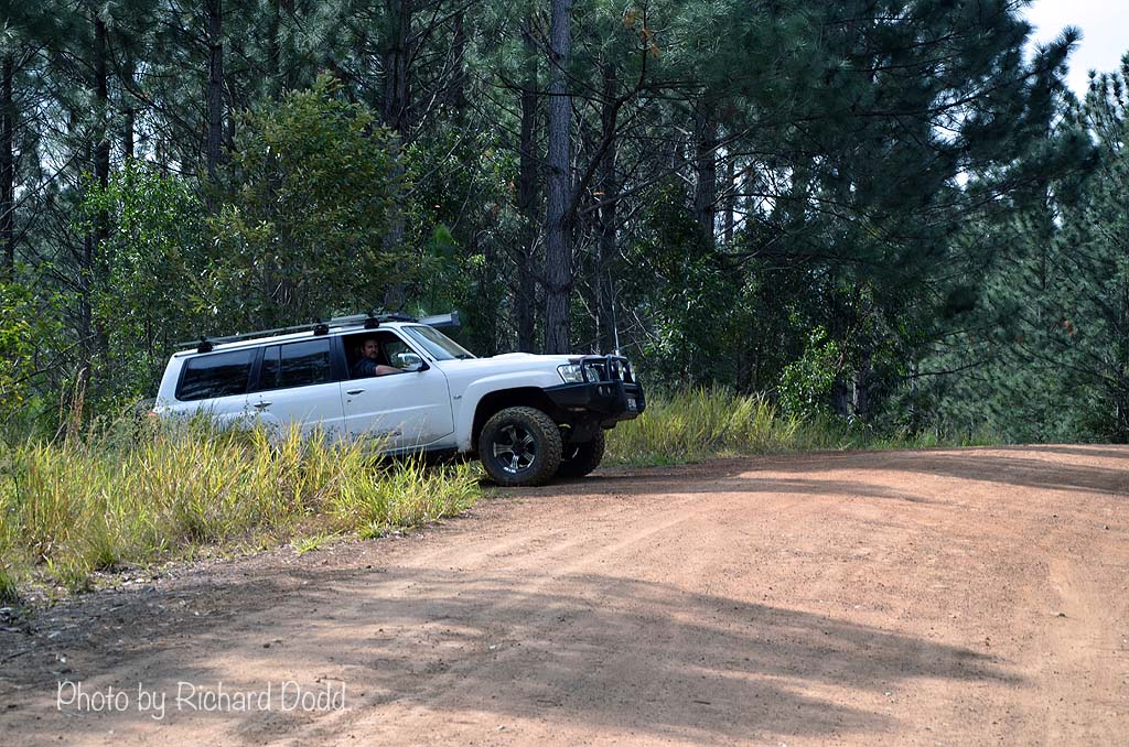
We had myself and Matt Gleadhill, Justin and Daryl Goos, Richard Dodd and Rodney Galloway. We met up near Peachester on Reserve Lane and made our way through Peachester State Forest (PSF) to join up with the well travelled and well known track called "Powerline".
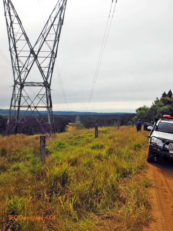
Although there are 3 lots of power lines in the general glasshouse area, there are two of them that run past the western side of Mount Beerwah and if you here someone say they are going to drive "Powerline", they almost certainly mean the Western most power lines.
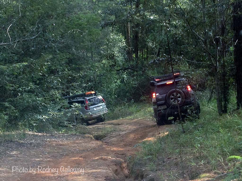
The drive through PSF was pleasant and uneventful as the tracks had been graded not too long ago. I have seen the tracks in this area in much worse condition. On the Southernmost boundary of the PSF we crossed Sandy Creek and took a left hand turn toward the well known "Mud Mile" for a quick look but it was flooded and too cold to be playing in bog holes so we went back to Powerline and turned left toward the Fire Tower (the pink pin on the centre left of the map) where we had a look at Widowmaker and other nasty tracks in the vicinity.
On a side note, there is a facebook group called "Glasshouse Area 4WD Hub" which can be found "here". They have a really handy interactive google map which shows the best known, and probably the most heavily travelled, tracks in the area. That can be found by clicking "here". They are colour coded to denote their level of difficulty and even if it is marked as easy, don't assume it still will be when you get there. The Glasshouse area changes constantly, especially after heavy rain when many go out to play in the mud and chew it up.
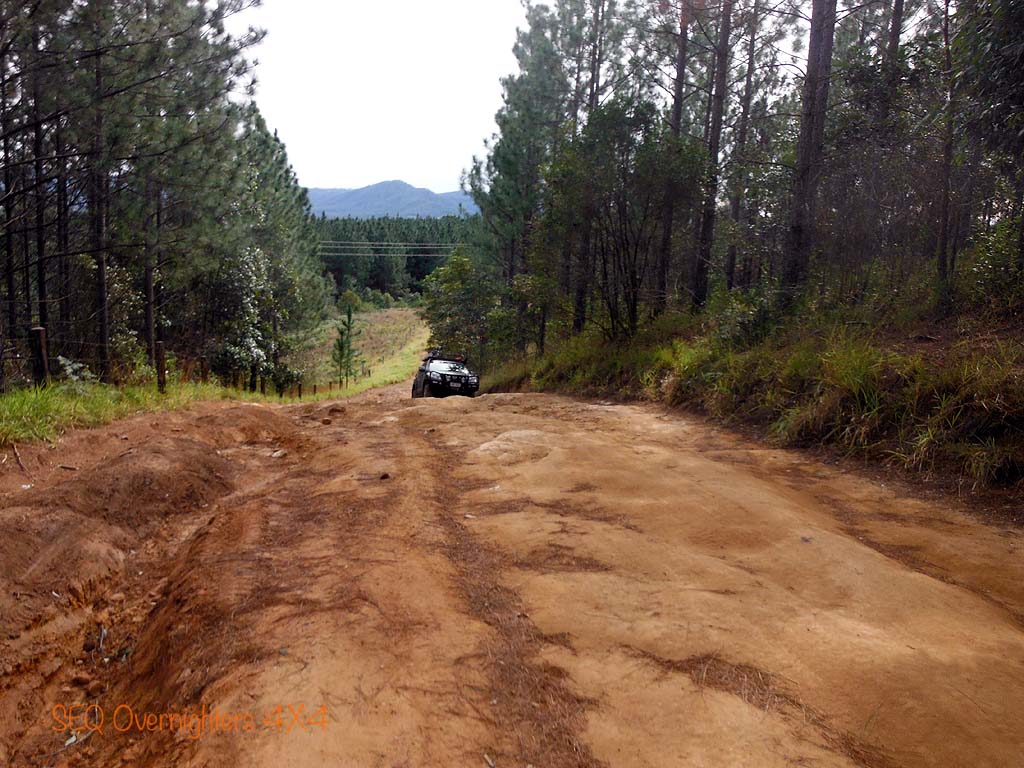
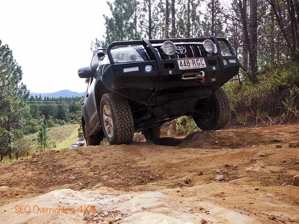
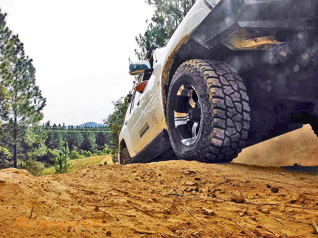
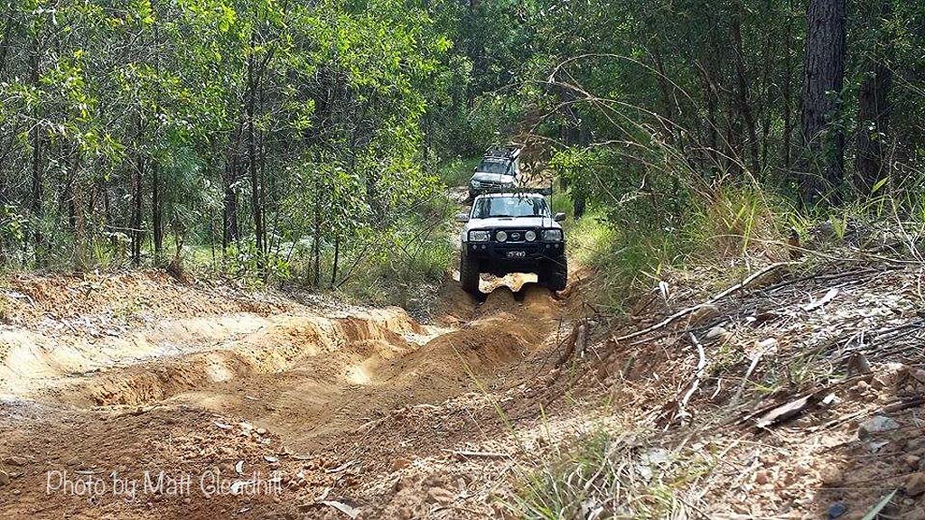
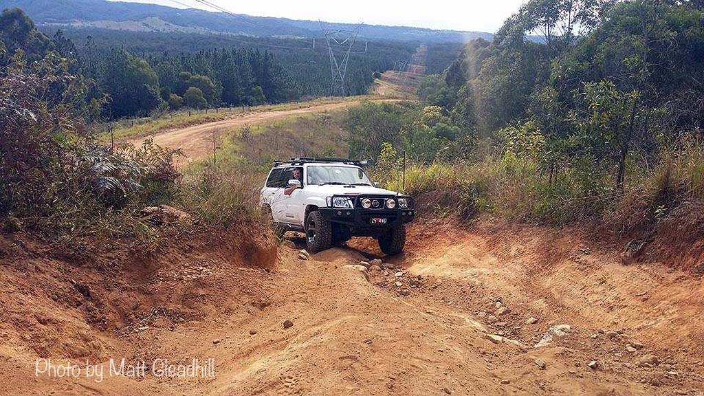
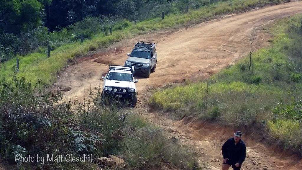
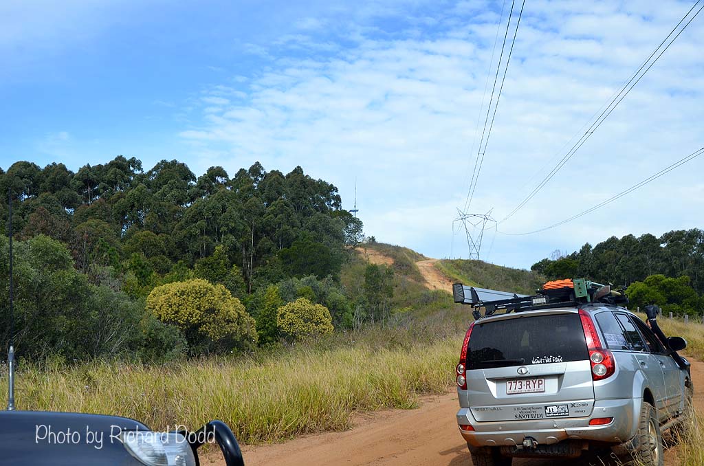
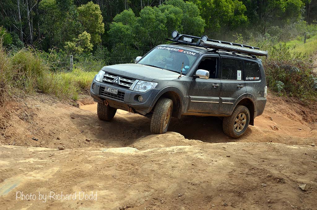
So, back to our story. We left the Fire Tower and had a slight detour to play on another short track and and a fun little corner with a challenging little climb and decent before we continued South along Poweline. The track was a little rougher than usual but easily passable and to be honest, we didn't always take the easiest path. Where's the fun if you just take the easiest route all the time? We stopped on the Northern side of Beerburrum-Woodford Road, opposite "Big Red" (an infamous hill climb) and a couple of the vehicles had a go at a couple of short but challenging climbs.
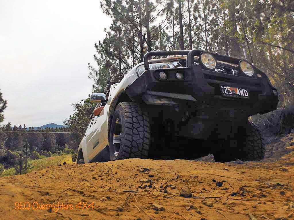
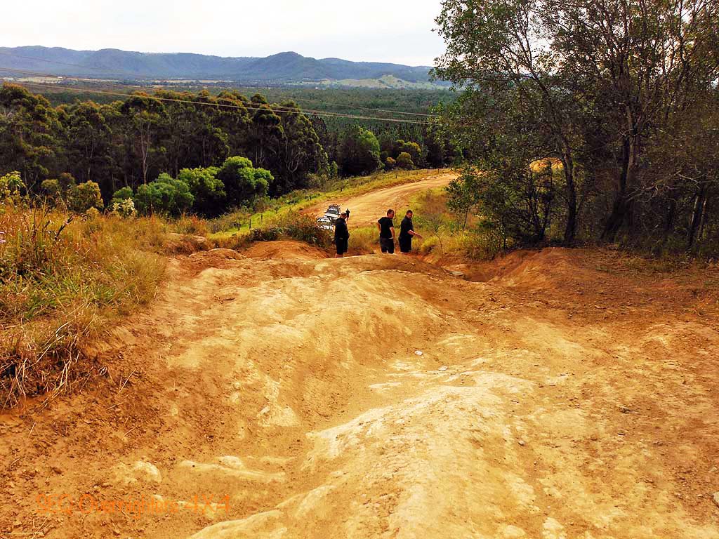
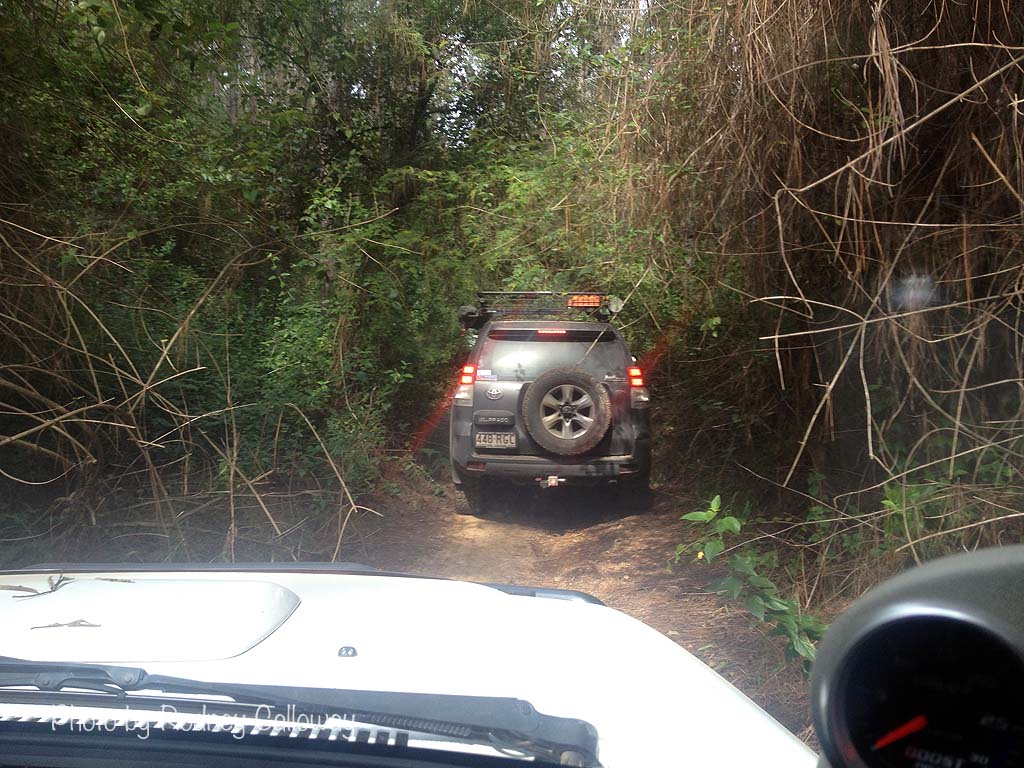
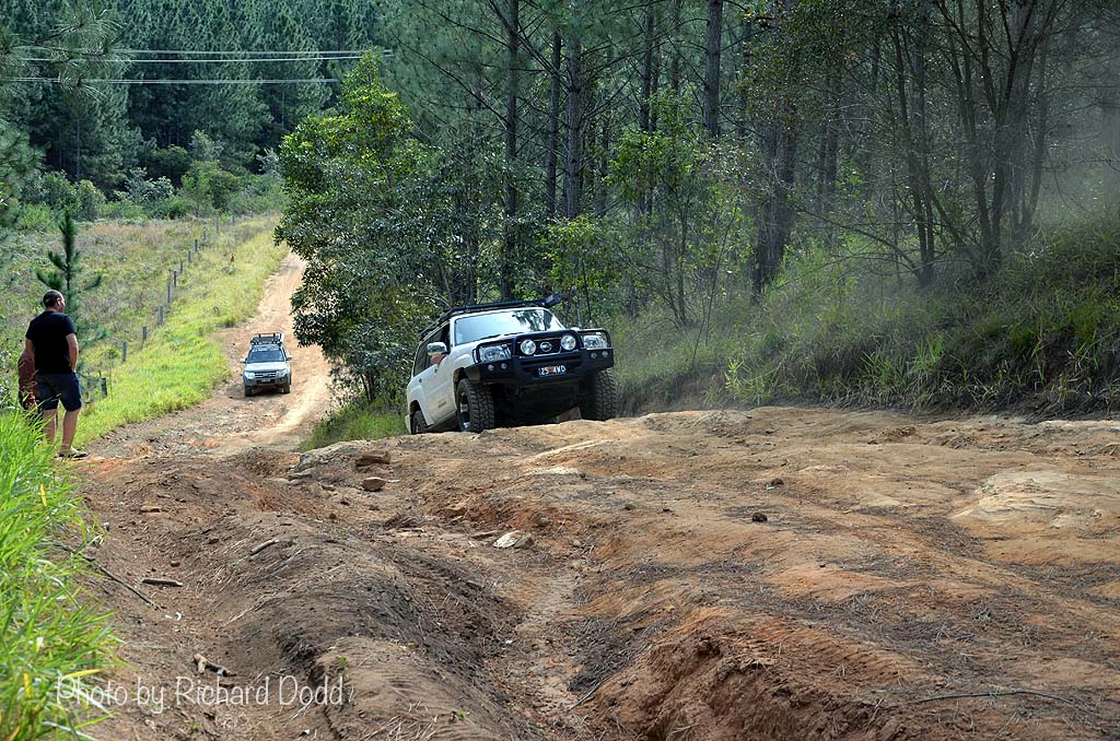
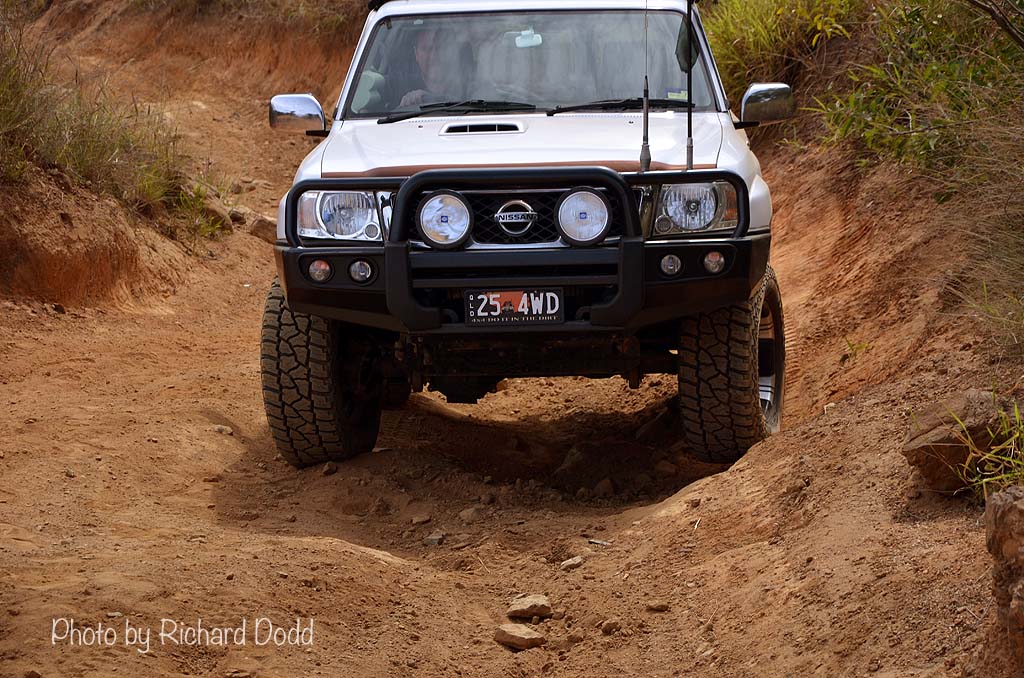
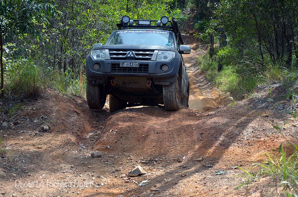
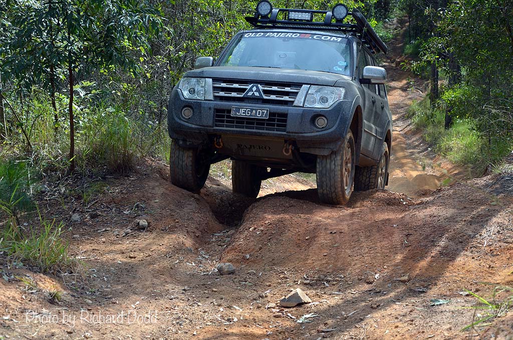
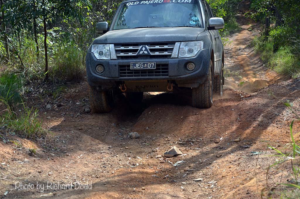
Crossing Beerburrum-Woodford Road we had a look at the top of Big Red and then drove down the chicken track to have a look at "Little Red" and the Little Red chicken track but none of us were comfortable doing even that so we made our way out and down and back onto Powerline to cross over and onto another track that I don't know the name of which loops back up to the Beerburrum-Woodford Road. This used to be quite an easy track but I wouldn't take a beginner on it now as it has changed quite a bit with weather and traffic, as any other track in Glasshouse does.
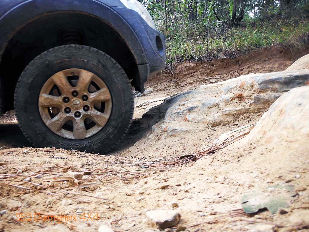
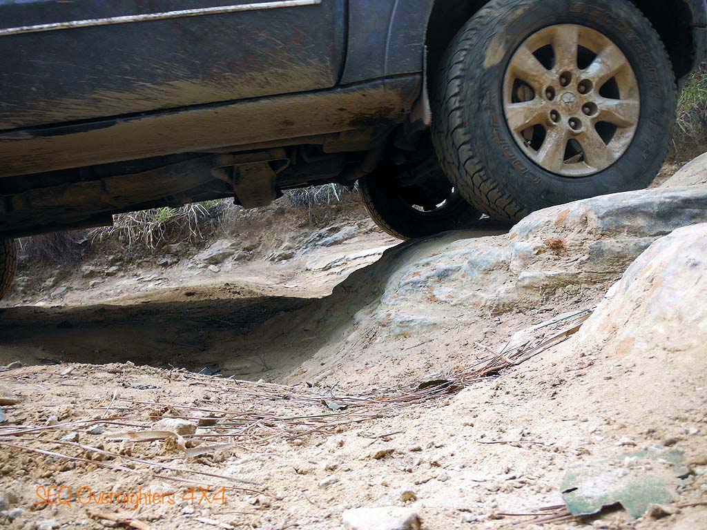
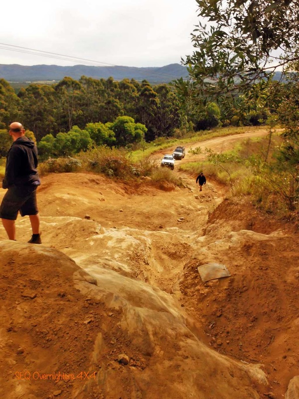
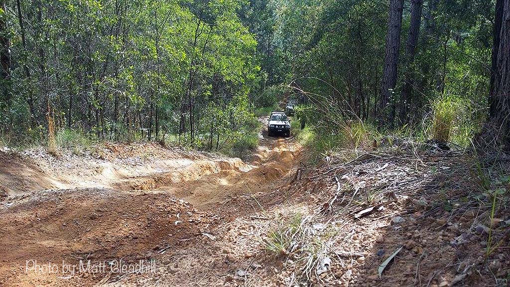
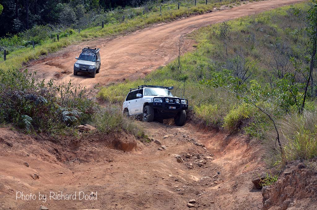
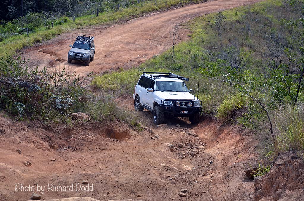
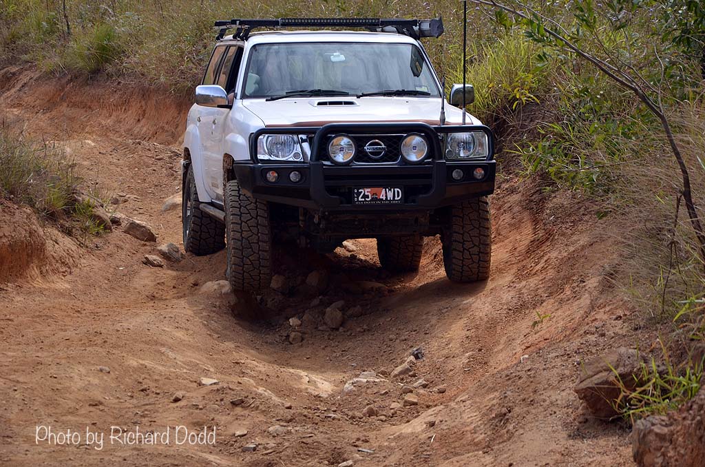
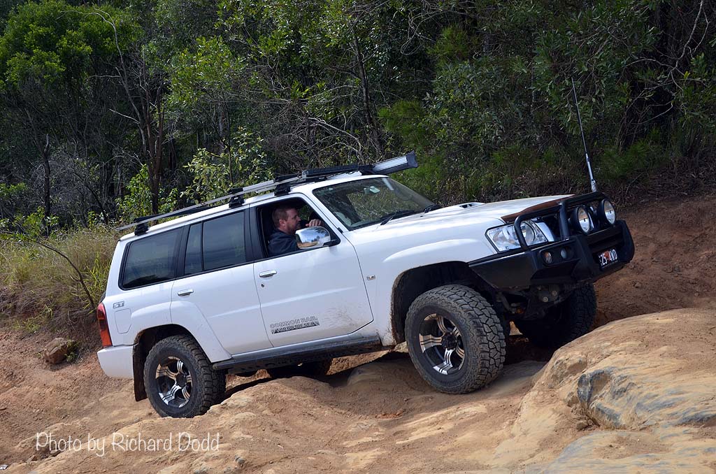
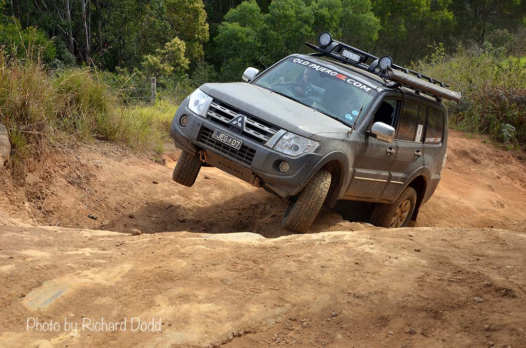
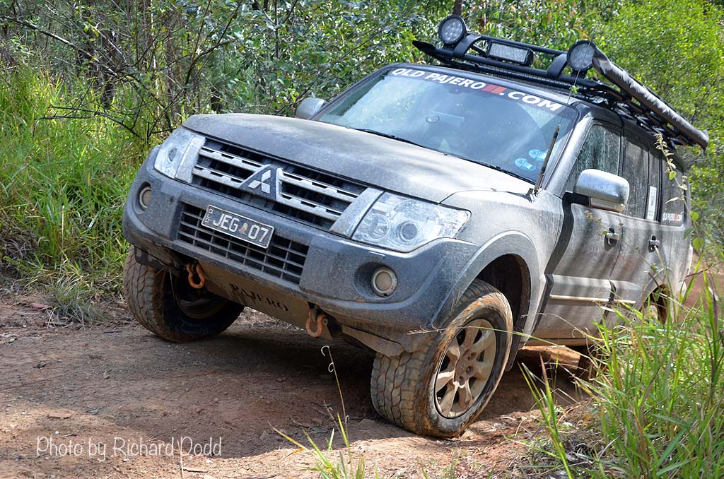
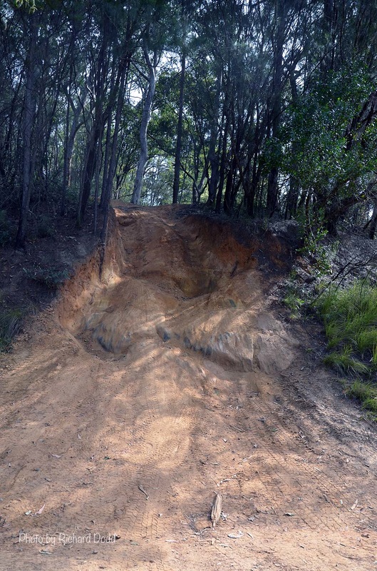
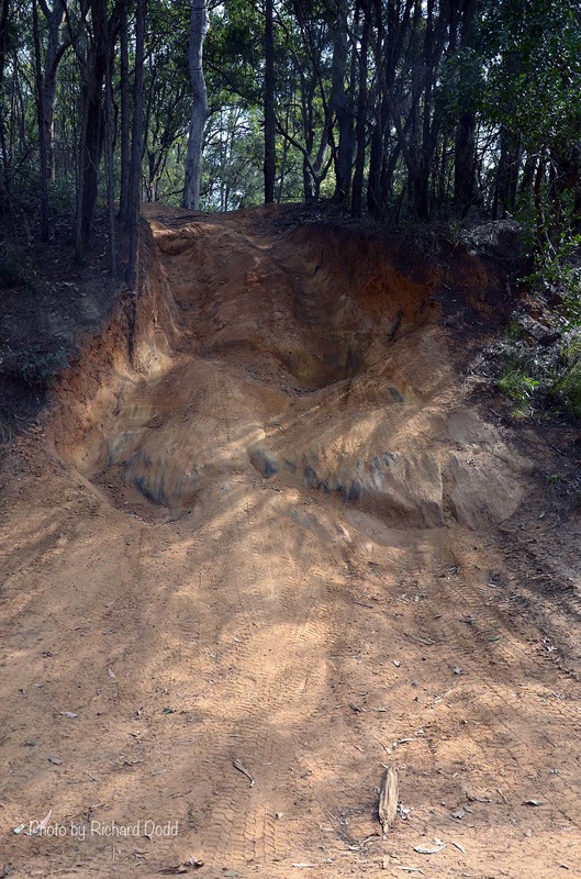
On this Track, you pass and upturned car which has been there for some years and then climb a short steep bank with a rutt and tree roots in the middle. to go to one side and try and get around it wasn't really the best option so we straddled it carefully and drove over it. I went first and without a guide and misjudged it and the driver's side slipped down into the v shaped rutt. A bit of pedal and some magic on the steering wheel and we climbed out.
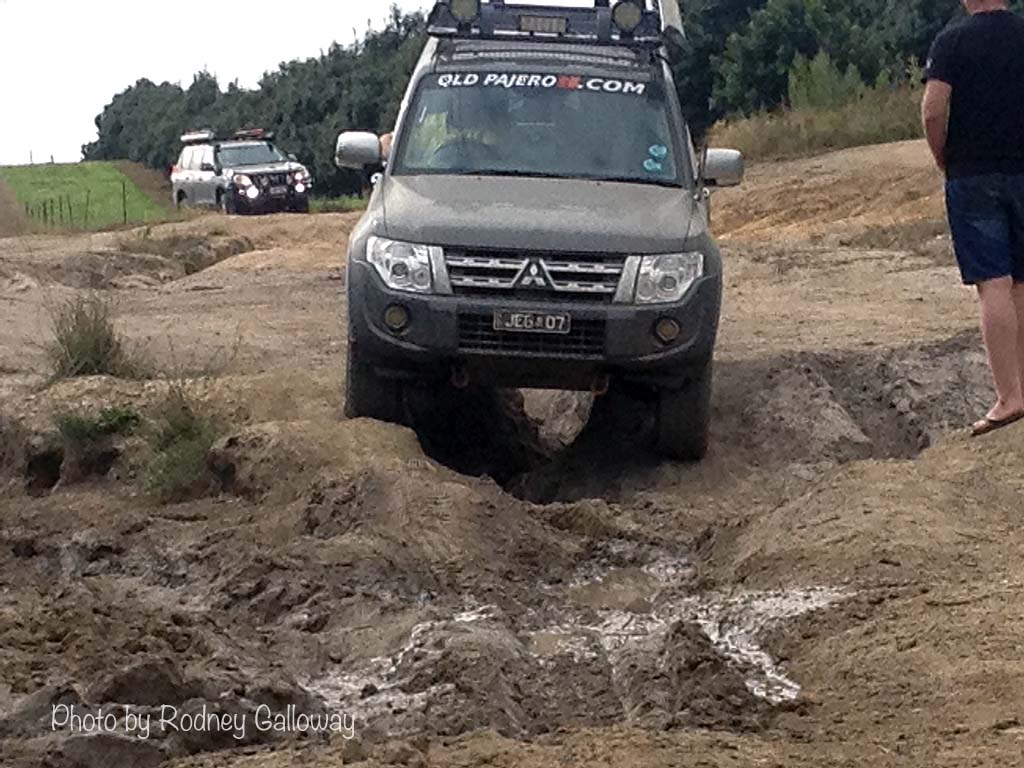
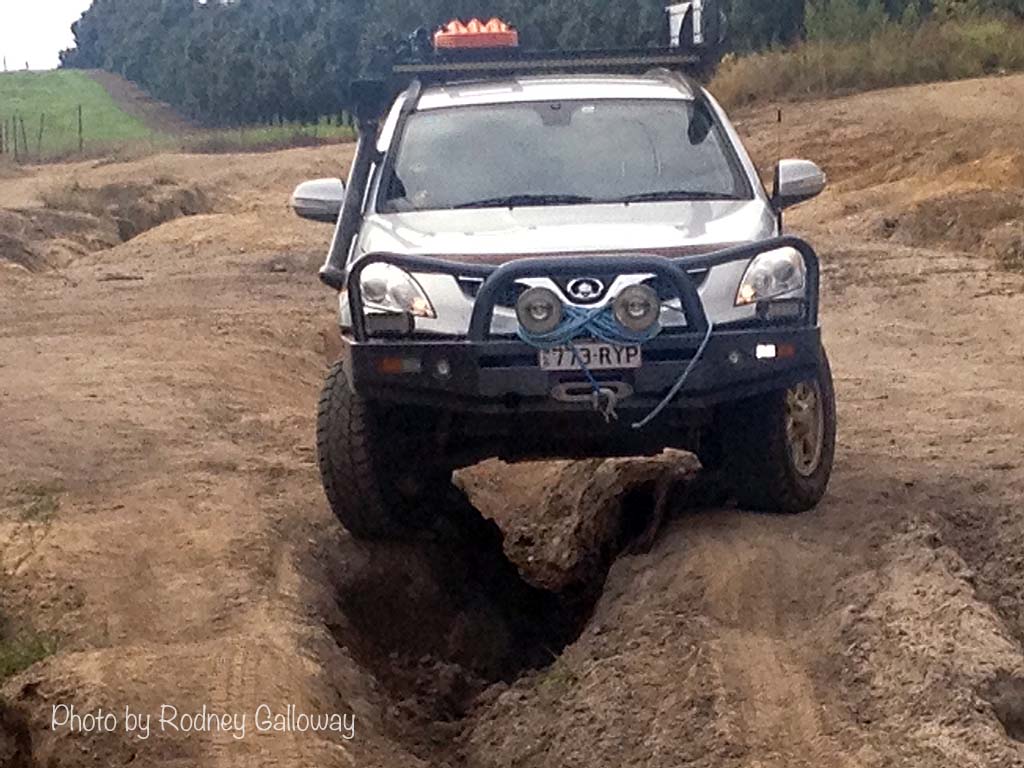
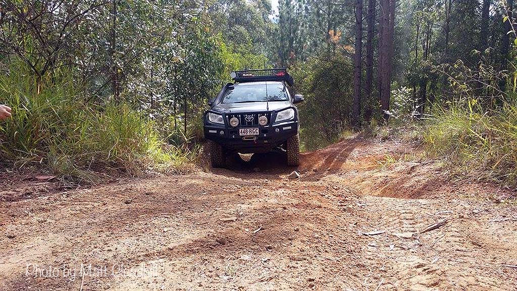
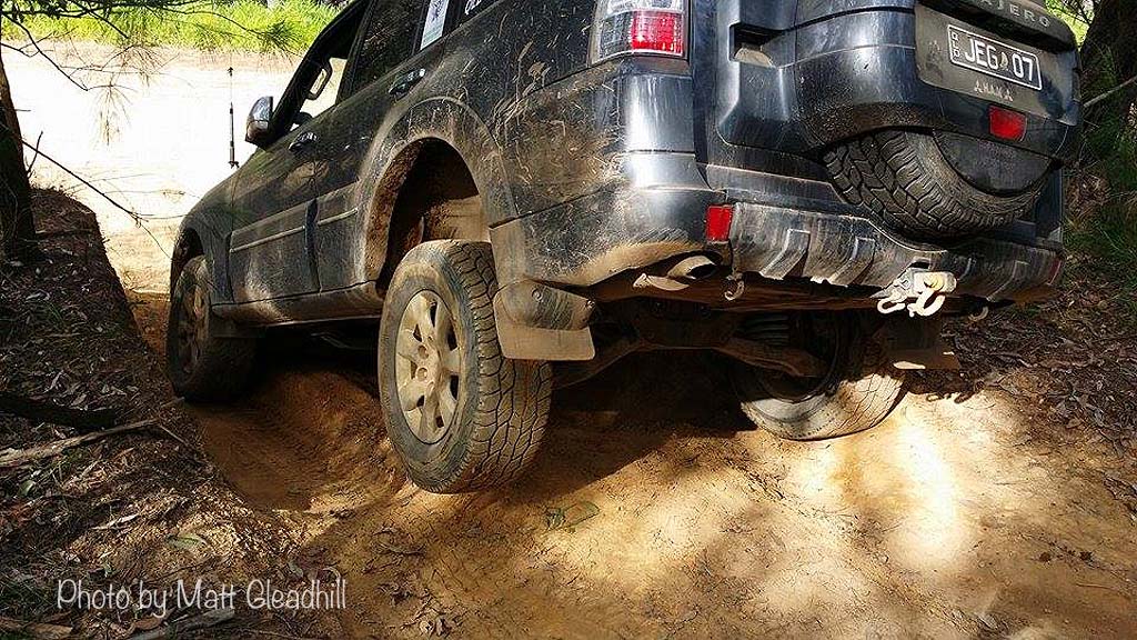
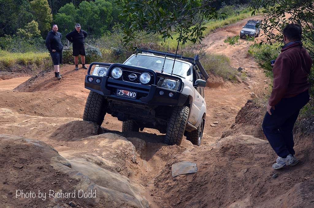
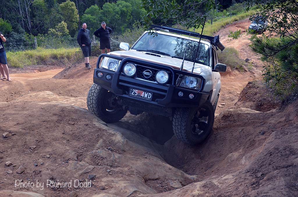
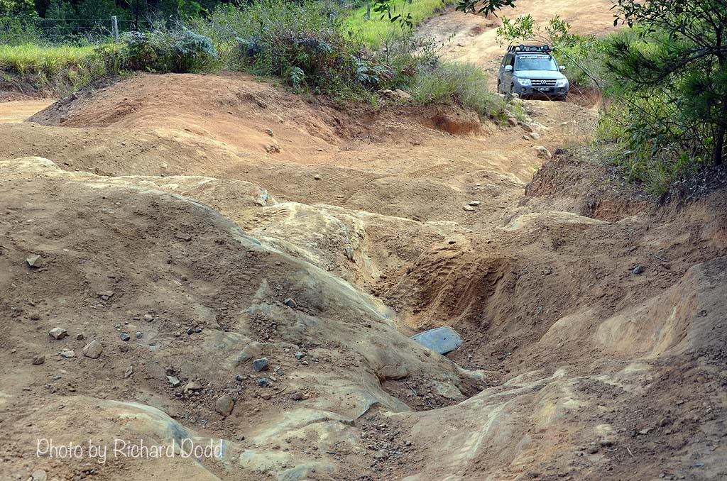
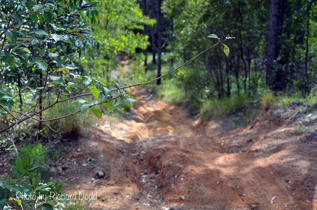
I have no idea what the angle was like or how far of the ground my left front tyre was but it felt pretty high. The other 3 vehicles came through under guidance without an issue. Unfortunately we don't have photos of that spot. I have some old photos of it but it was nowhere near as bad when I was there last. We continued up the track through a little overgrowth here & there and some rocky areas where all the soil has been washed away. The entire track was worse than I had ever seen it but it was great fun.
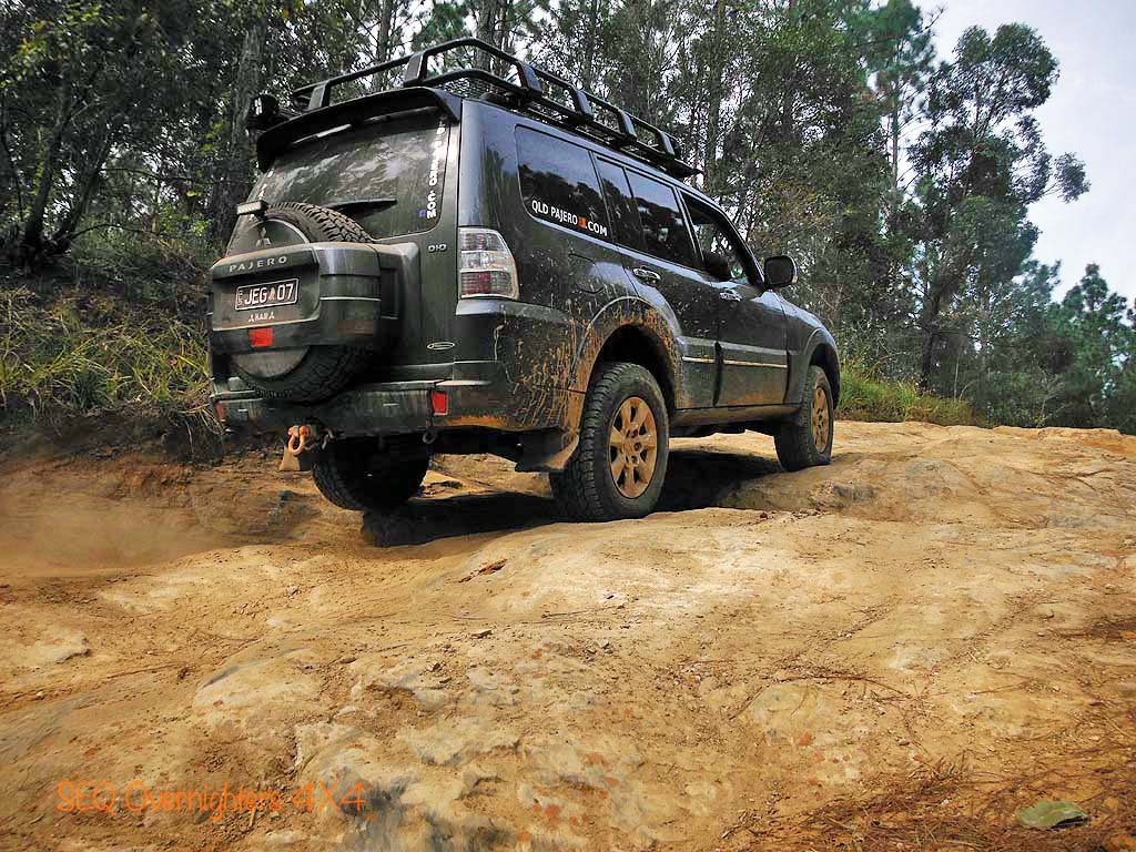
At the top of the track, Justin & Daryl and Rodney blew up their tyres and headed for home. Matt and I carried on with Richard and did one last track below the GHM lookout before coming back onto Old Gympie Road and heading for home. Matt and I stopped in at the PUMA Garage to air up before hitting the highway for the run home. Despite the late start we had a great time and tackled some tracks that were a bit more difficult than anything I would normally do on a monthly group trip but our crew were all keen and experienced enough to do the tracks we did. I think we each added to our individual collections of bush pin striping on a couple of tracks too.
My thanks to those that came along and eased my boredom and restored a little sanity to my world.
As usual, photos without the watermark may be purchased in various sizes by visiting the shop page "here" and quoting the image number that appears on mouseover or in the caption. If the image belongs to a member, you will be put in touch with that member. Any money raised from photo sales goes back into the group in the form of free raffle prizes.
HEMA App Track Stats:
Total track distance - 39.4kms.
Not that I could really spare the fuel but I was itching to get out of the house and although this was not a scheduled group event, I had already invited a member to ride shotgun and I threw it up on the group's page. One vehicle with two people soon became 4 vehicles with 6 people.
We had myself and Matt Gleadhill, Justin and Daryl Goos, Richard Dodd and Rodney Galloway. We met up near Peachester on Reserve Lane and made our way through Peachester State Forest (PSF) to join up with the well travelled and well known track called "Powerline".
Although there are 3 lots of power lines in the general glasshouse area, there are two of them that run past the western side of Mount Beerwah and if you here someone say they are going to drive "Powerline", they almost certainly mean the Western most power lines.
The drive through PSF was pleasant and uneventful as the tracks had been graded not too long ago. I have seen the tracks in this area in much worse condition. On the Southernmost boundary of the PSF we crossed Sandy Creek and took a left hand turn toward the well known "Mud Mile" for a quick look but it was flooded and too cold to be playing in bog holes so we went back to Powerline and turned left toward the Fire Tower (the pink pin on the centre left of the map) where we had a look at Widowmaker and other nasty tracks in the vicinity.
On a side note, there is a facebook group called "Glasshouse Area 4WD Hub" which can be found "here". They have a really handy interactive google map which shows the best known, and probably the most heavily travelled, tracks in the area. That can be found by clicking "here". They are colour coded to denote their level of difficulty and even if it is marked as easy, don't assume it still will be when you get there. The Glasshouse area changes constantly, especially after heavy rain when many go out to play in the mud and chew it up.
So, back to our story. We left the Fire Tower and had a slight detour to play on another short track and and a fun little corner with a challenging little climb and decent before we continued South along Poweline. The track was a little rougher than usual but easily passable and to be honest, we didn't always take the easiest path. Where's the fun if you just take the easiest route all the time? We stopped on the Northern side of Beerburrum-Woodford Road, opposite "Big Red" (an infamous hill climb) and a couple of the vehicles had a go at a couple of short but challenging climbs.
Crossing Beerburrum-Woodford Road we had a look at the top of Big Red and then drove down the chicken track to have a look at "Little Red" and the Little Red chicken track but none of us were comfortable doing even that so we made our way out and down and back onto Powerline to cross over and onto another track that I don't know the name of which loops back up to the Beerburrum-Woodford Road. This used to be quite an easy track but I wouldn't take a beginner on it now as it has changed quite a bit with weather and traffic, as any other track in Glasshouse does.
On this Track, you pass and upturned car which has been there for some years and then climb a short steep bank with a rutt and tree roots in the middle. to go to one side and try and get around it wasn't really the best option so we straddled it carefully and drove over it. I went first and without a guide and misjudged it and the driver's side slipped down into the v shaped rutt. A bit of pedal and some magic on the steering wheel and we climbed out.
I have no idea what the angle was like or how far of the ground my left front tyre was but it felt pretty high. The other 3 vehicles came through under guidance without an issue. Unfortunately we don't have photos of that spot. I have some old photos of it but it was nowhere near as bad when I was there last. We continued up the track through a little overgrowth here & there and some rocky areas where all the soil has been washed away. The entire track was worse than I had ever seen it but it was great fun.
At the top of the track, Justin & Daryl and Rodney blew up their tyres and headed for home. Matt and I carried on with Richard and did one last track below the GHM lookout before coming back onto Old Gympie Road and heading for home. Matt and I stopped in at the PUMA Garage to air up before hitting the highway for the run home. Despite the late start we had a great time and tackled some tracks that were a bit more difficult than anything I would normally do on a monthly group trip but our crew were all keen and experienced enough to do the tracks we did. I think we each added to our individual collections of bush pin striping on a couple of tracks too.
My thanks to those that came along and eased my boredom and restored a little sanity to my world.
As usual, photos without the watermark may be purchased in various sizes by visiting the shop page "here" and quoting the image number that appears on mouseover or in the caption. If the image belongs to a member, you will be put in touch with that member. Any money raised from photo sales goes back into the group in the form of free raffle prizes.
Photos in this gallery from my waterproof point & shoot.
Photos in this gallery by Rodney Galloway
Photos in this gallery by Matt Gleadhill
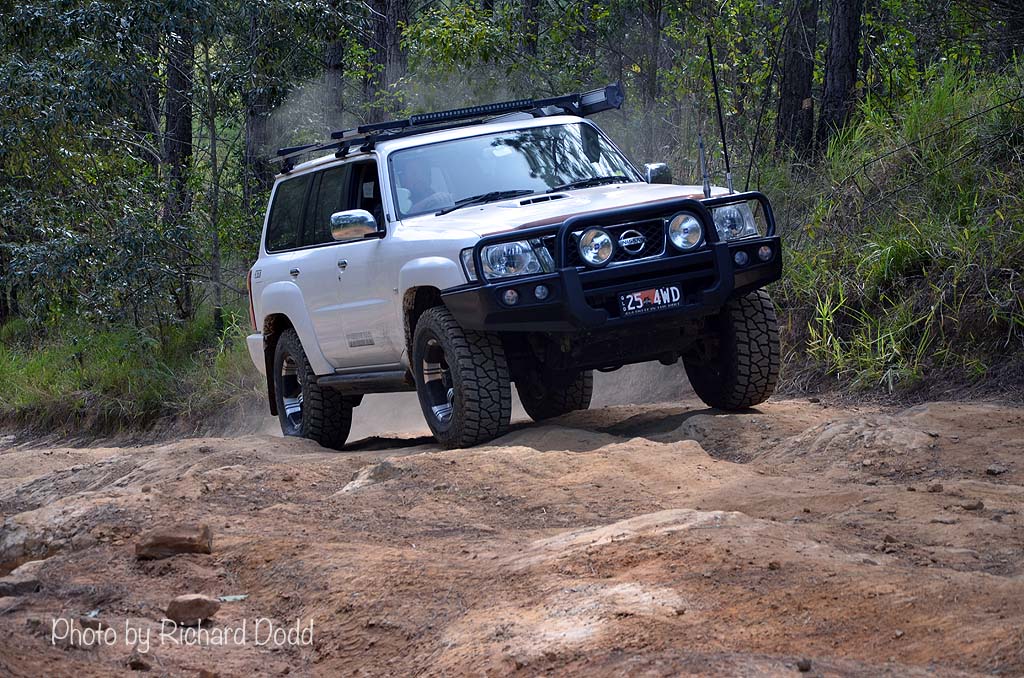
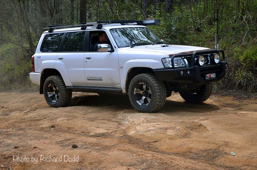
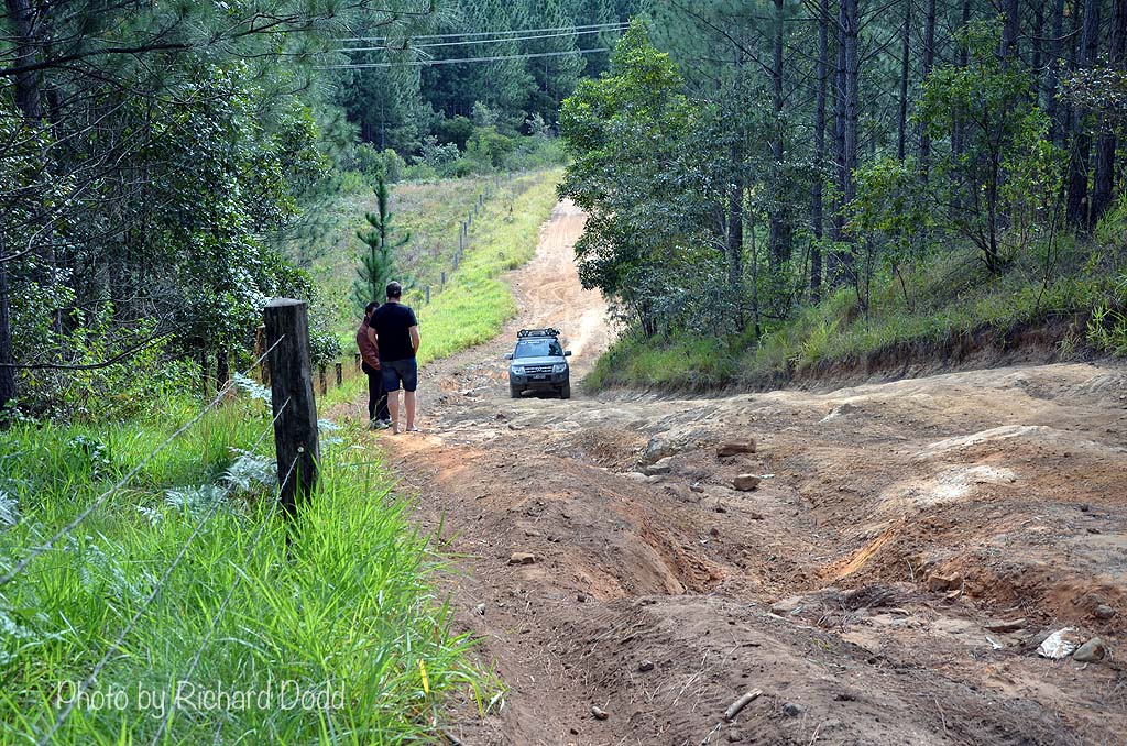
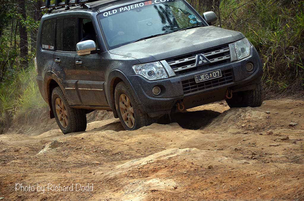
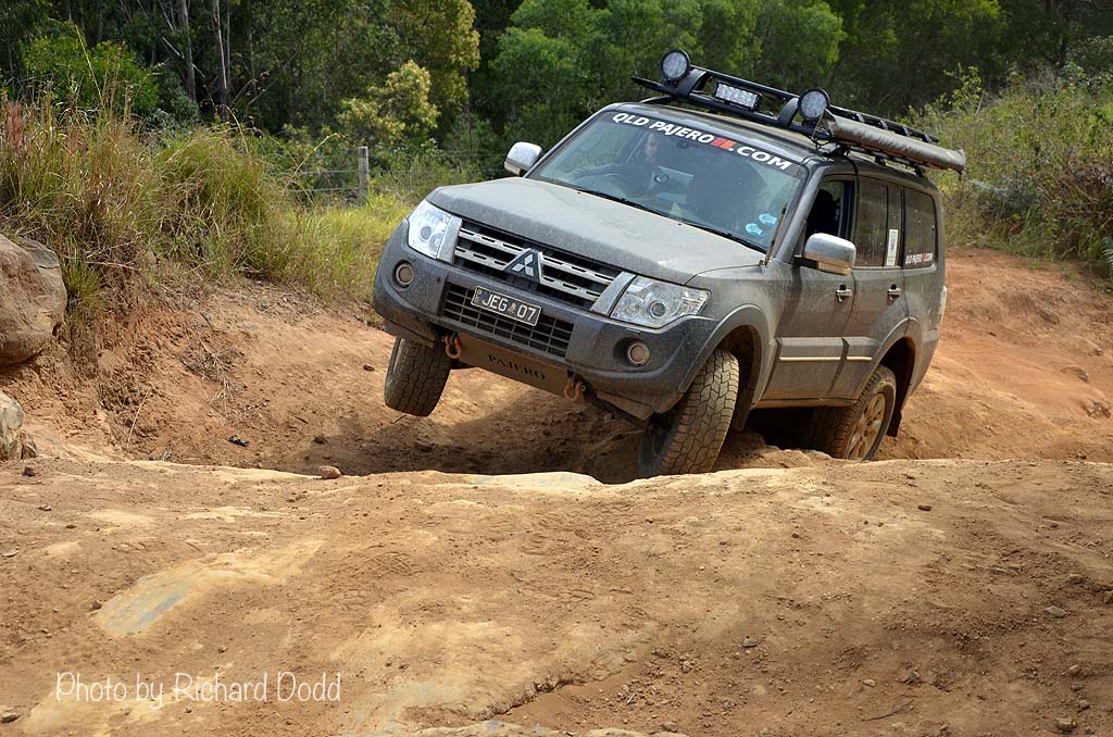
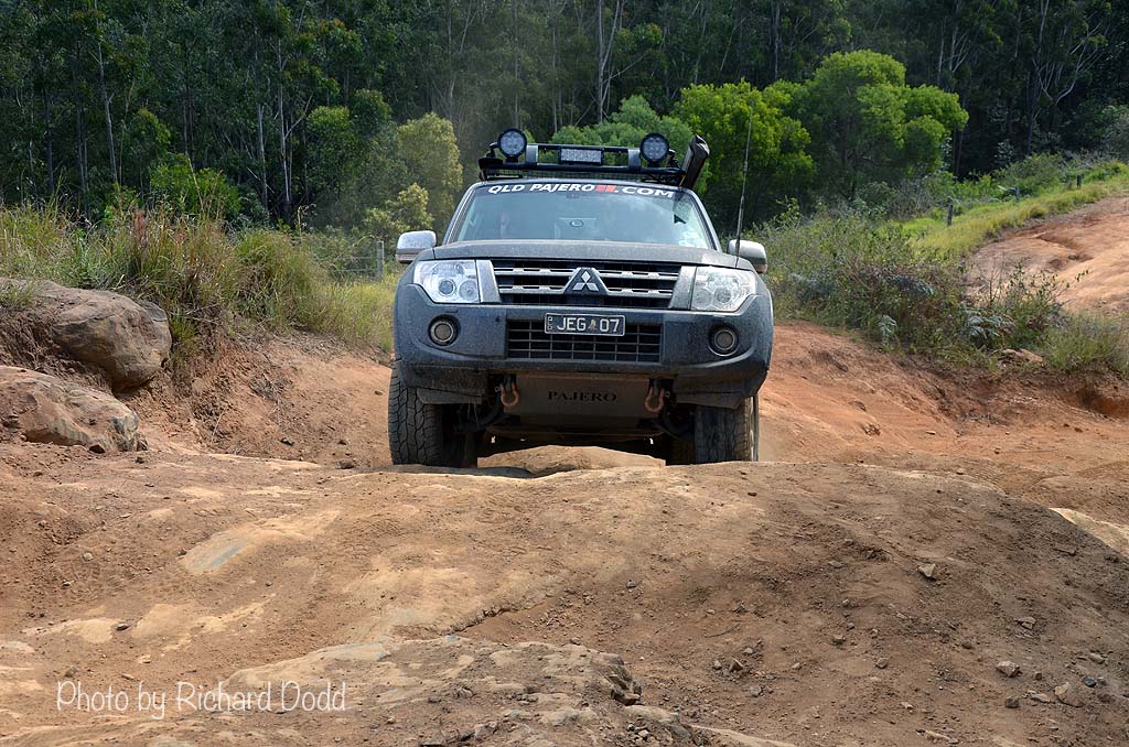
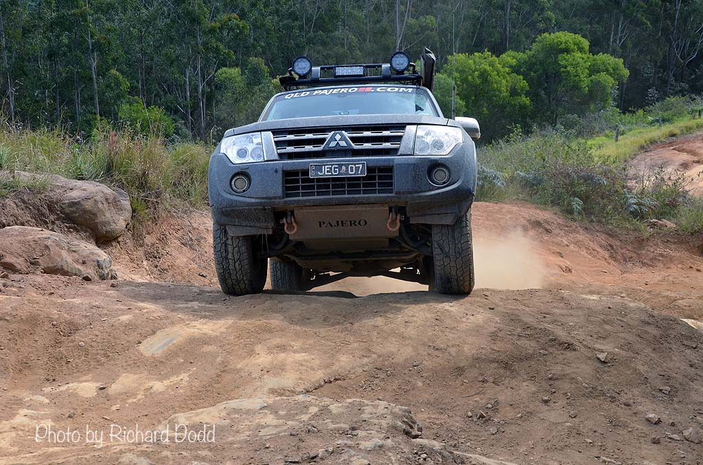
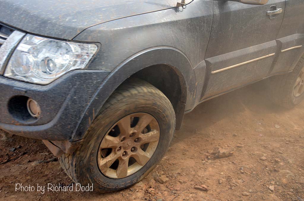
Photos in this gallery by Richard Dodd
HOME | ABOUT | UPDATES | TRIP REPORTS | GALLERY | SPONSORS | FORUM | LINKS | SITEMAP
contact | prize winners
All content on this site is © Copyright and may not be downloaded, saved or used in any way without permission.
If I do not own the image, I will put you in contact with the person that does. Please use the form on the contact page.
contact | prize winners
All content on this site is © Copyright and may not be downloaded, saved or used in any way without permission.
If I do not own the image, I will put you in contact with the person that does. Please use the form on the contact page.
